For a while now, scaling Mt. Talinis had been a burning desire. So, when I heard my friend Michael was planning a traverse hike with his group over a weekend, I jumped at the chance to join. The proposed 3-day, 2-night itinerary resonated deeply, offering a balanced approach that prioritized both the challenge of the summit and the opportunity to truly appreciate the surrounding landscape. This unhurried pace promised a more enriching experience, allowing for ample rest breaks, exploration of off-the-beaten-path trails, and time to fully immerse ourself in the majesty of Mt. Talinis.
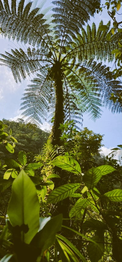
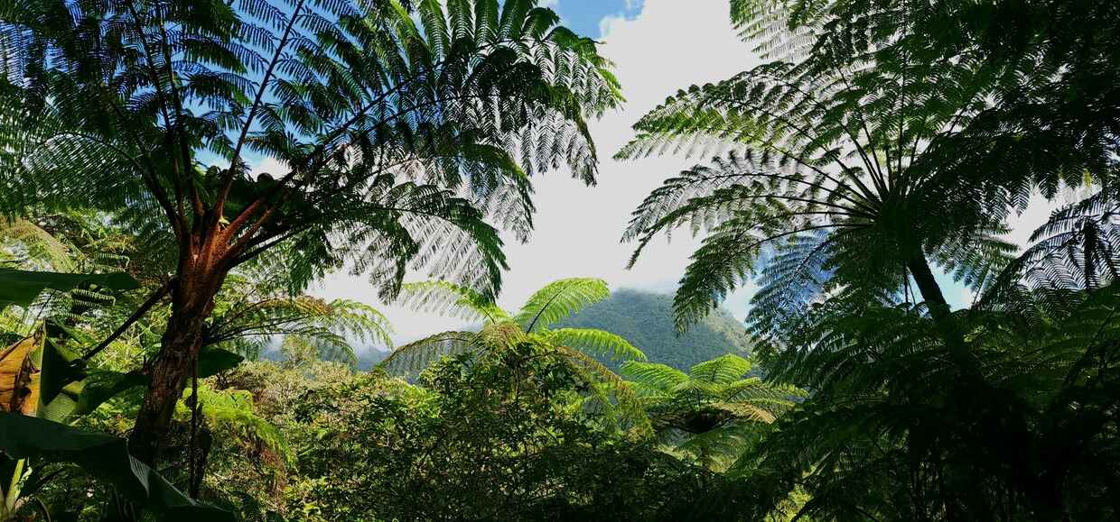
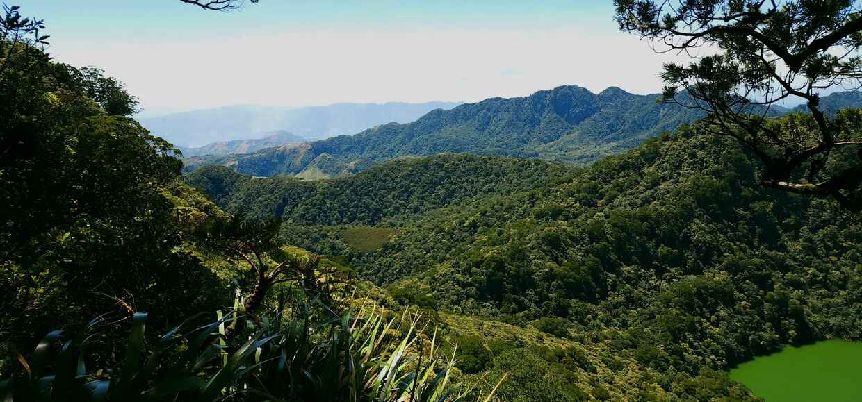
Mount Talinis, the second-highest peak on Negros Island, beckons with its epic traverse route. The dynamic terrain will test your limits as you conquer a distance of 12.8 kilometers to the summit, battling an elevation gain of up to 1425 meters from the Valencia jump-off point. Expect steep and slippery sections due to loose rocks and tree roots, interspersed with muddy trails and sections of thick jungle.
But the reward? An unforgettable trek that starts on one side of the mountain and finishes on the other, allowing you to experience the unique offerings of both the Valencia and Dauin trails in a single journey.
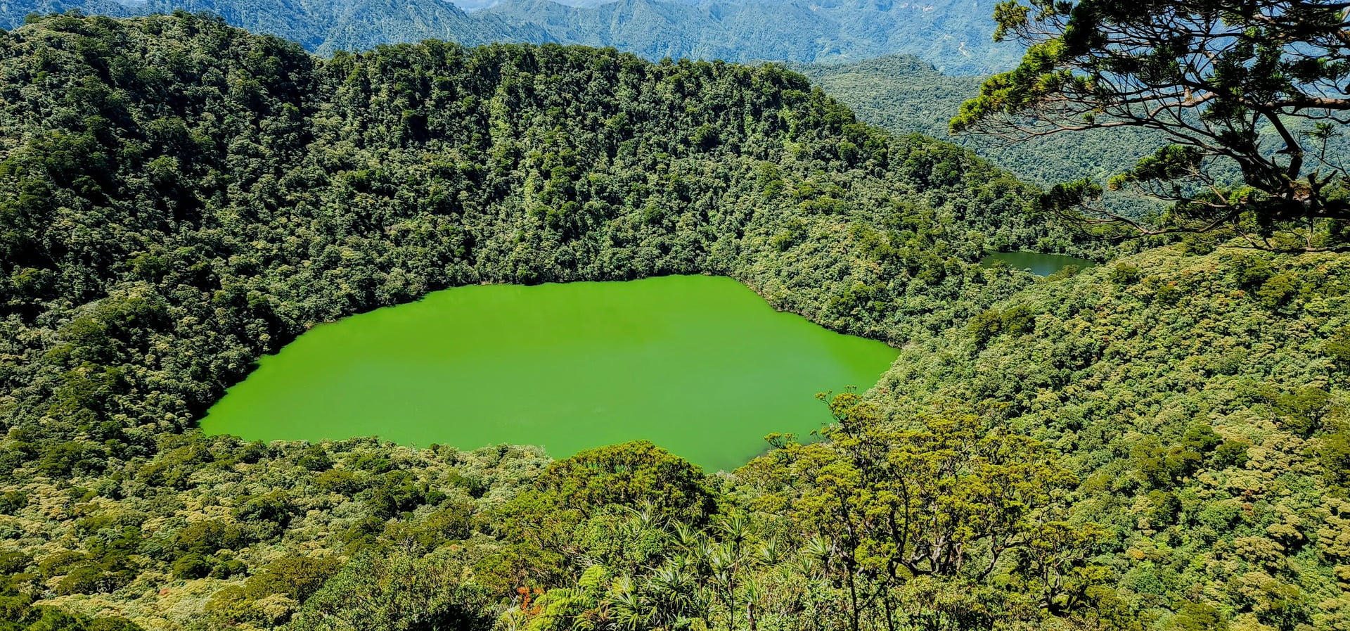
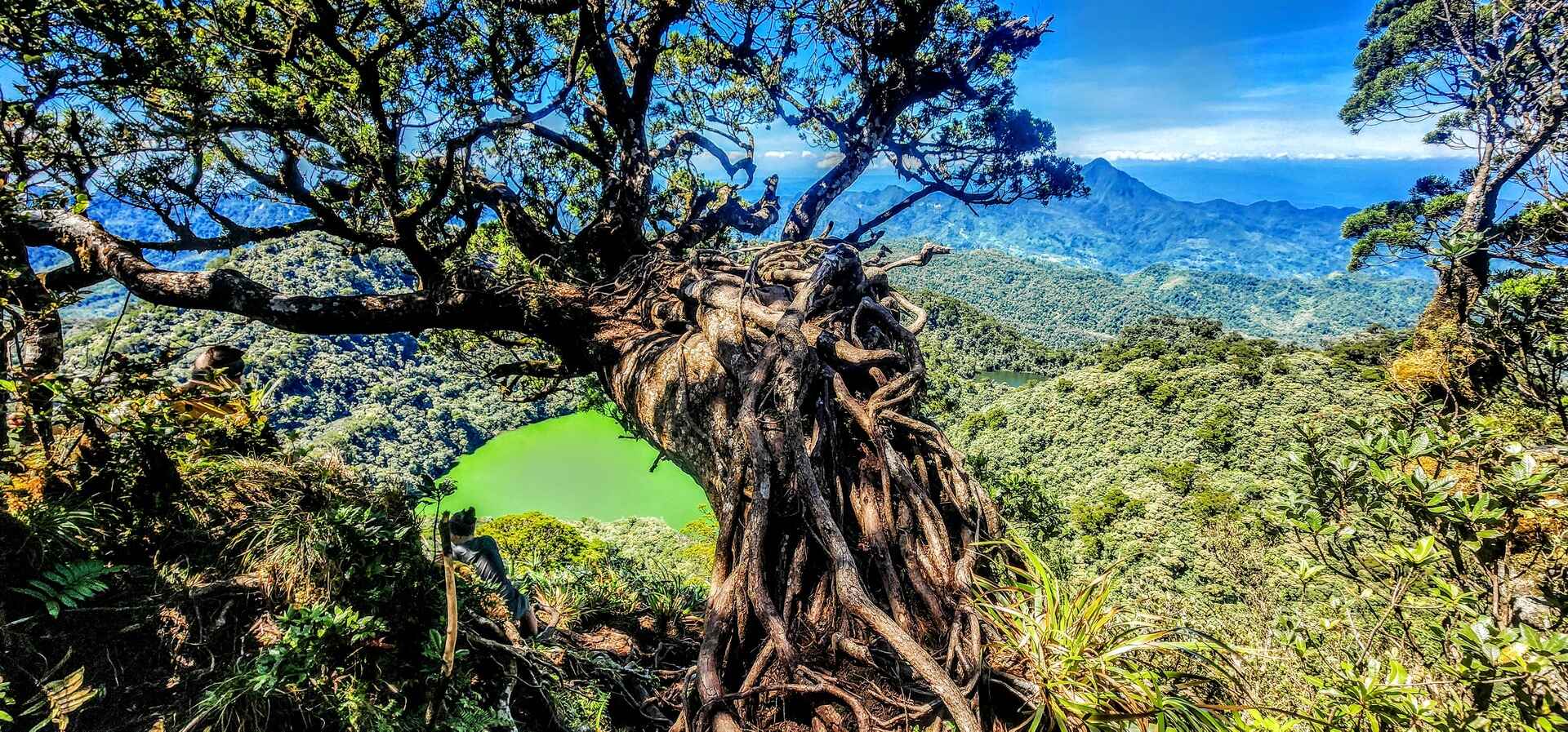
Our second night’s camp was established on the shores of Lake Nailig, a visually stunning yet geologically complex location. The lake’s caldera walls, formed by volcanic processes, create a dramatic and imposing backdrop. Due to environmental regulations, swimming in the lake and open campfires were not permitted.
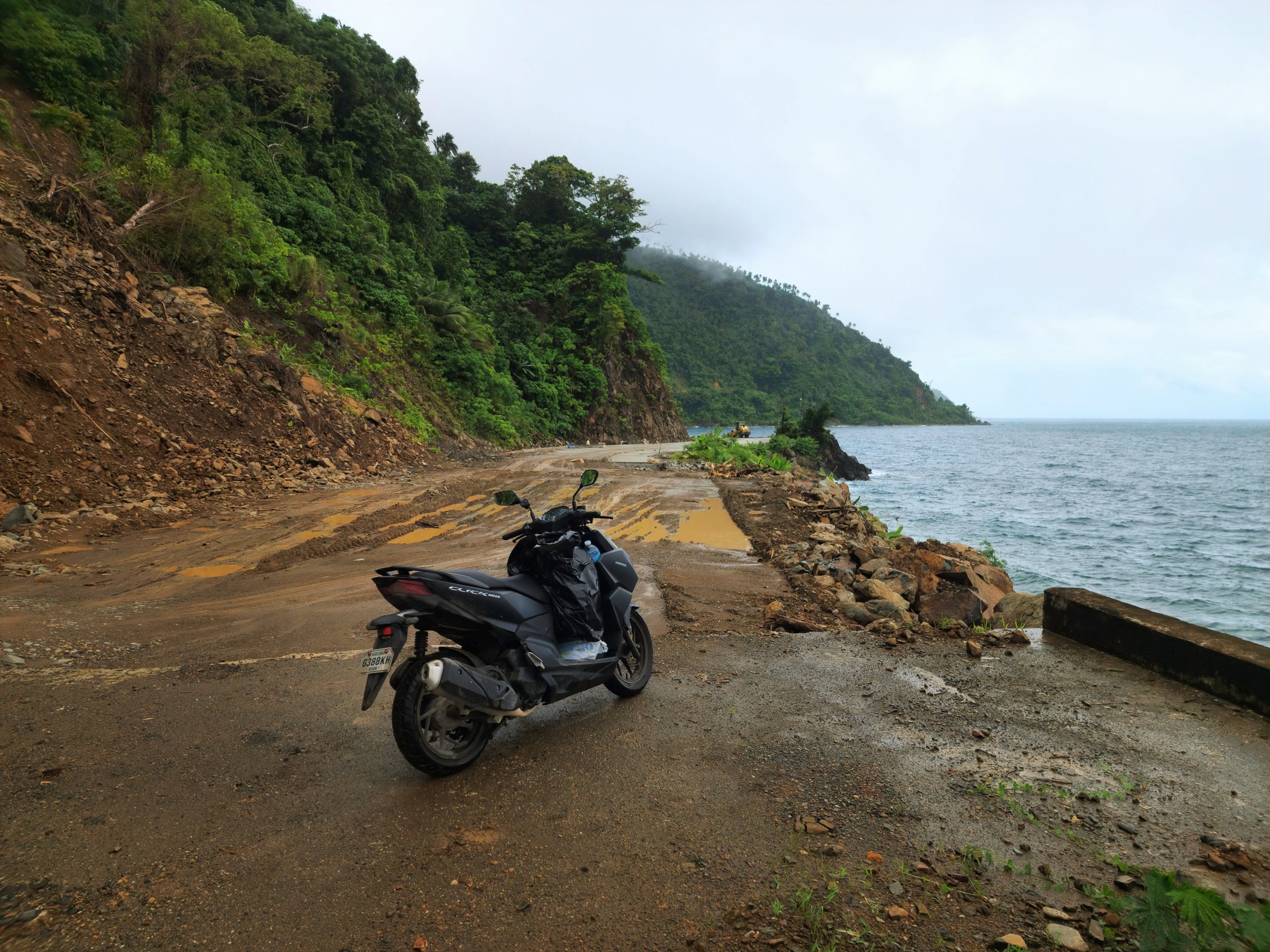
I departed Moalboal by scooter on the prior day. Traveling south, I proceeded towards the port for the ferry service to Dumaguete, where I joined Michael and his group. We shared a few drinks and lively conversation on the hotel’s rooftop terrace, enjoying the pleasant atmosphere.
The next morning, the sound of the alarm clock startled us awake. With a quick breakfast and a sip of coffee, we received a message from our jeepney driver, who awaited us on the street below. We made our way to the entrance of Casaro Falls (Apolong Trailhead,), the starting point of our adventure.
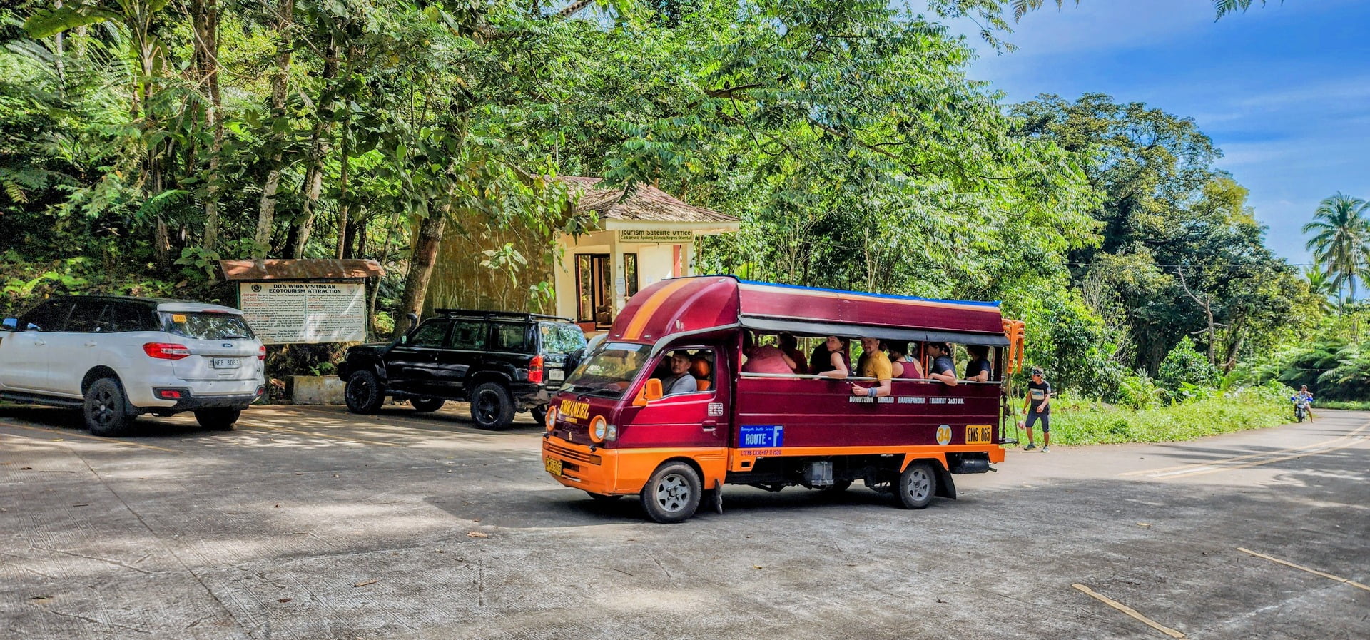
As the jeepney arrives at Casaro Falls (Apolong Trailhead), our group eagerly disembarks, ready to embark on the first leg of our hike. Surrounded by lush greenery and the sound of cascading water, we begin our journey.
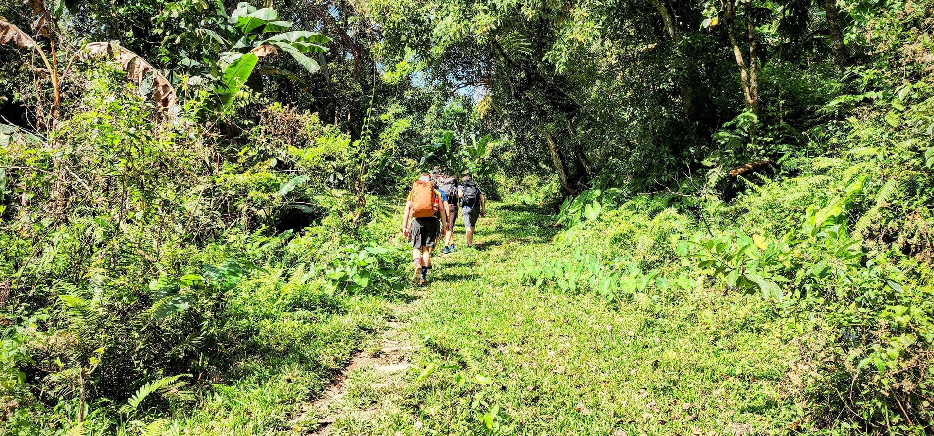
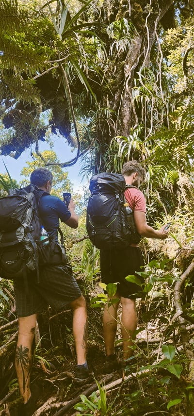
Upon arrival, we were greeted by our guides and porters. After a brief introduction and sorting out paperwork, we embarked on the trail. The initial hours were spent traversing a beautiful jungle-like path until we reached a crucial water guard station. Here, water guards play a vital role in ensuring the uninterrupted flow of a precious resource – the lifeblood of Dumaguete City. These individuals undertake two week-long deployments into the heart of the mountain, their primary mission being the meticulous monitoring and safeguarding of Dumaguete’s water supply.
The water guard station is a pivotal stopover along the Mt. Talinis trail, strategically positioned to assist hikers on their journey. Here, weary trekkers find solace, as they replenish their water provisions, take a moment to rest, and indulge in a nourishing meal during lunchtime.
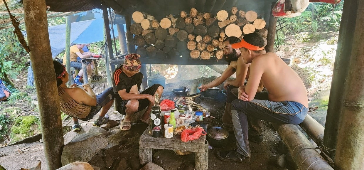
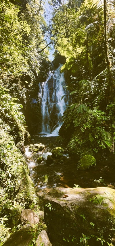
At the water guard station, our porters were busy preparing lunch while we went to inspect and enjoy a twin falls nearby.
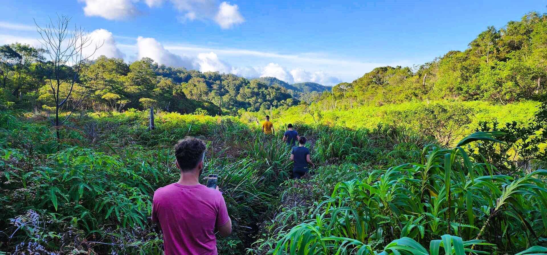
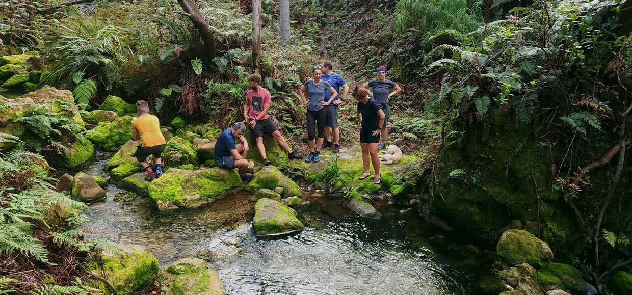
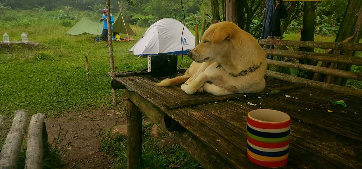
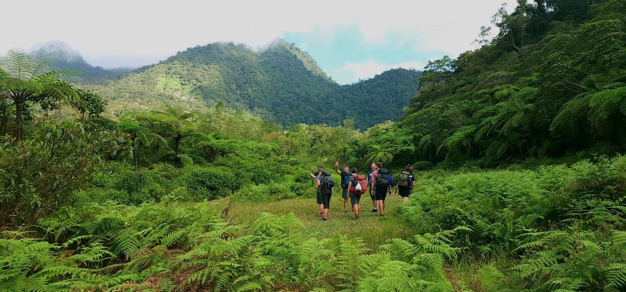
While our guide prepared a meal, we seized the opportunity to explore the nearby twin waterfalls, marveling at their beauty and the refreshing water. After a satisfying lunch, we continued our trek, crossing streams and ascending to our first campsite. Accompanied by a local lady, her child, and their loyal dog, we were enchanted by the scenic wonders reminiscent of Jurassic Park.
With our tents pitched, we took a brief break before embarking on a 30-minute hike to Sulfur Vents. The landscape was adorned with beautiful volcanic formations and twisted trees, creating a mesmerizing spectacle for our senses. A unique sulfurous aroma filled the air, a testament to Mt. Talinis’ volcanic activity.
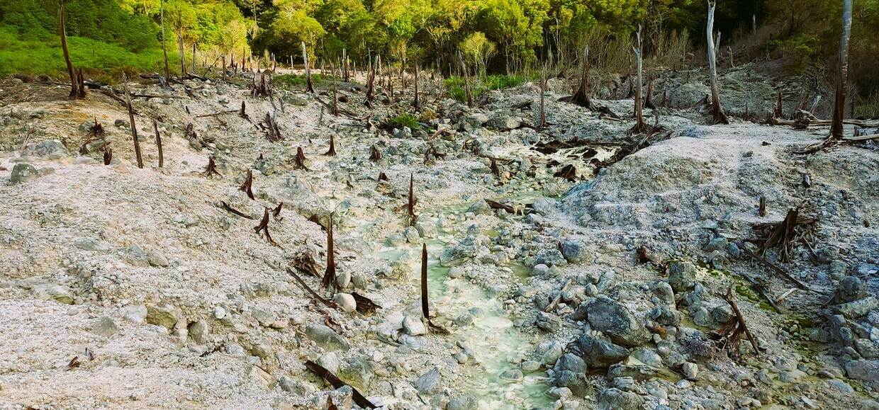
The Sulfur Vents of Mount Talinis, also known as the Kaipohan Sulfur Vents, are a fascinating sight. These vents are a result of volcanic activity and emit sulfuric gases that create a unique barren landscape. The area around the vents is characterized by dead trees and bleached rocks, creating an otherworldly atmosphere.
Upon arriving back at our camp, our guides set about preparing dinner. Eager for refreshment, we went to a nearby river for a quick bath, replenishing our drinking water from a nearby spring using a small portable filter. As night descended, the chill set in, prompting me to don an extra layer of clothing.
The following morning, we woke up bright and early at 6:00 a.m., enjoying a hearty breakfast before embarking on our hike towards Lake Nailig, where we would spend another night. Our guides skillfully arranged the camp and prepared lunch for us, allowing for some much-needed rest before we resumed our trek towards the summit of Mt. Talinis.
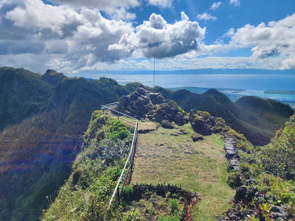
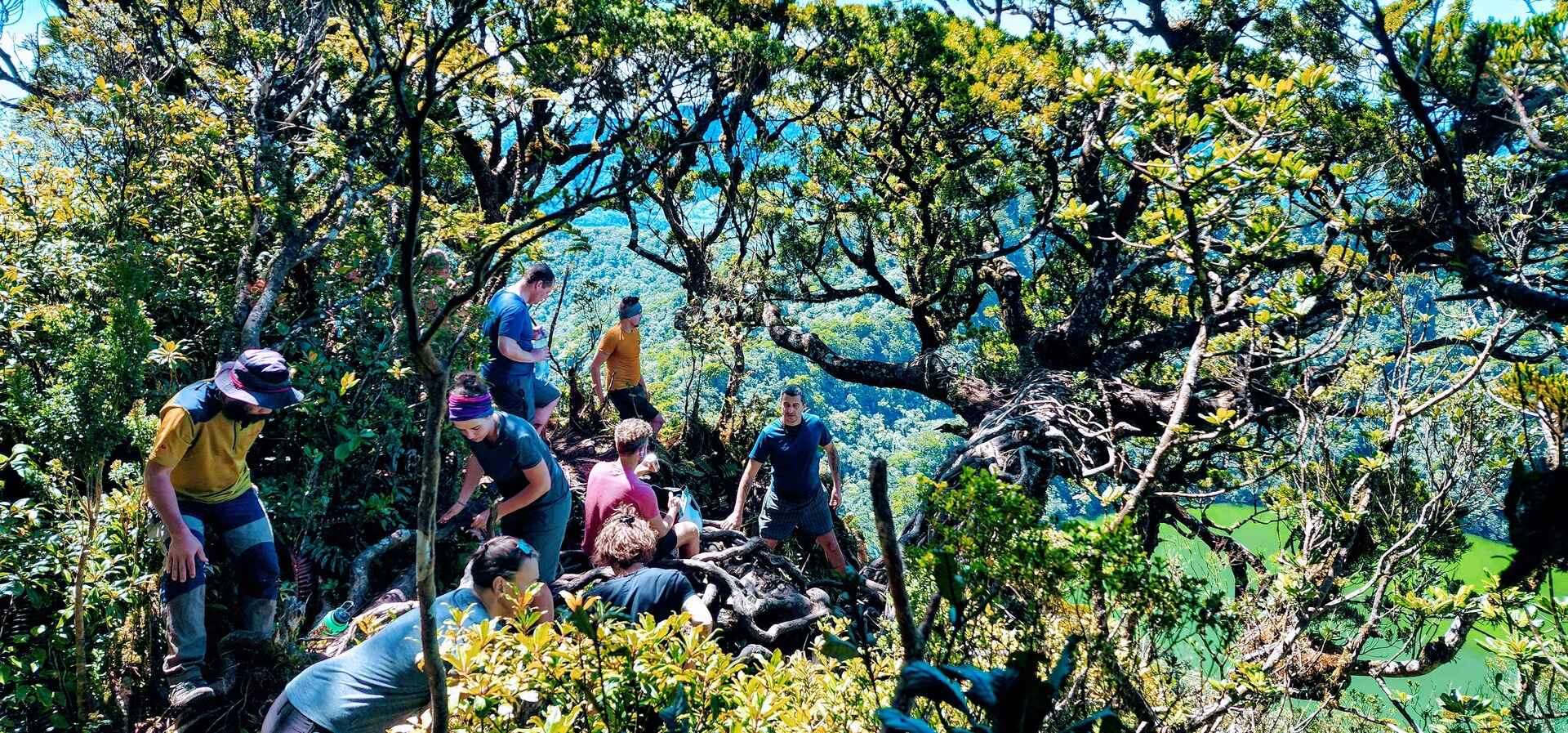
The ascent to the summit of Mt. Talinis proved to be the most challenging segment of our trek, characterized by steep inclines and a rapid gain in elevation that almost resembled climbing. Despite the difficulty, it was a satisfying and energizing experience, taking us less than an hour to conquer.
Upon reaching the mountaintop, we savored the opportunity to capture breathtaking photos and immerse ourselves in the surrounding beauty, even catching a glimpse of the distant Cebu Island. The descent demanded increased caution, requiring about 25 minutes of careful navigation.

Lake Nailig, nestled amidst the lush greenery of Mt. Talinis, captivates with its serene beauty.
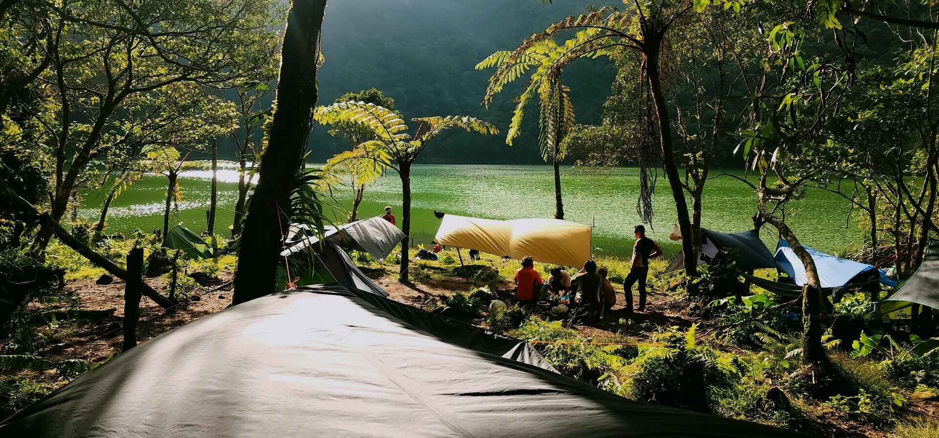
Left: A serene campsite nestled beside the glassy surface of Lake Nailig. Relaxation sets in after a challenging descent from Mount Talinis. Right: The majestic summit of Mount Talinis dominates the view, offering breathtaking panoramas.
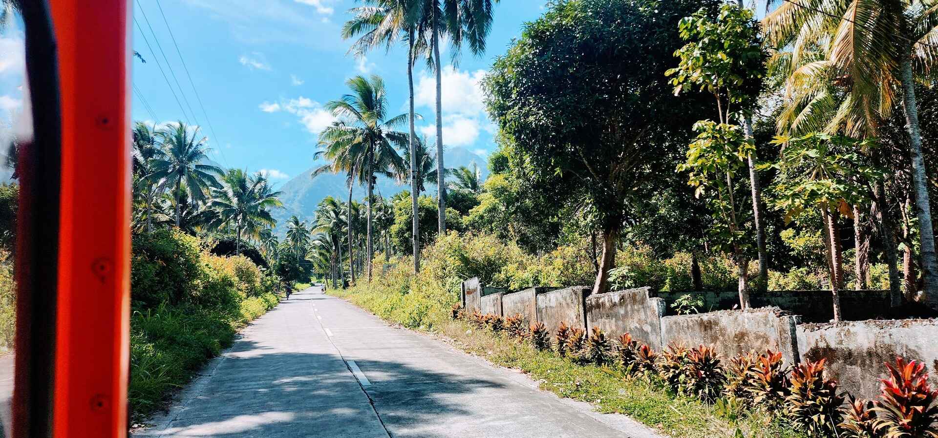
The following morning, we descended via the Bediao trail. This part of the trail was quite steep, and we went downhill quickly, losing a lot of elevation. Upon reaching Lake Yagumyum, we paused briefly before continuing our descent towards Dauin. Afterward, we strolled along the concrete road for a few minutes until we reached the first sari-sari store. There, we enjoyed a celebratory beer break while waiting for our jeepney ride back to Dumaguete.
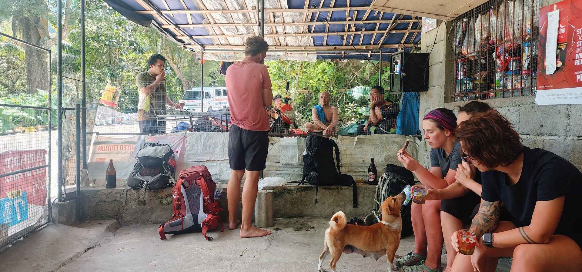
Cold beers and salty chips provided the perfect post-hike refreshment, a well-deserved reward for conquering the mountain.
Route Options
There are three main routes to conquer Mt. Talinis, allowing you to choose the path that best suits your skills and aspirations:
- Apolong Trail: A Scenic Journey
This is the most common route, starting and ending at the Casaroro Falls Trailhead in Valencia. Prepare to be enchanted by a variety of landscapes, from cascading waterfalls to intriguing sulfur vents. Along the way, hikers will navigate river crossings and tackle challenging ascents. Rest stops await at designated campsites at Rancho and Lakes Nailig, providing a chance to recharge before the final ascent to the summit.
2. Bediao Trail: A Shorter, Steeper Challenge
This steeper and shorter route is a good option for experienced hikers seeking a more direct ascent and descent. It starts and finishes at the same location.
The Bediao Trail also offers one-day achievable option for exceptionally experienced hikers willing to push their limits. With a very early start (around 4-5 am) and allowing up to 12 hours for completion, it’s a physically demanding route with steep inclines and technical sections. While this ambitious one-day option exists, it’s important to remember the significant strain it places on your knees and ankles.
3. Traverse Option: For the Truly Adventurous
The traverse option combines both trails for a truly exhilarating experience. You’ll embark on the Apolong Trail from Valencia, soaking in its scenic beauty, and descend via the Bediao Trail to Dauin. While the Bediao offers less scenery, it provides a shorter return route.
| Feature | Apolong Trail | Bediao Trail | Traverse (Apolong – Bediao) |
|---|---|---|---|
| Difficulty | Challenging | Very Challenging | Moderate – Challenging |
| Duration (round trip) | 2-3 days | 2 days | 3-4 days |
| Distance (round trip) | 18.55 km | 14 km | Approximately 20 km |
| Estimated Elevation Gain | 5,016 ft (1,529 m) | 4,265 ft (1,400 m) | 5,016 ft (1,529 m) |
| Terrain | More gradual inclines, diverse landscapes | Steeper inclines, technical sections | More gradual inclines, diverse landscapes |
| Scenery | Waterfalls, sulfur vents, diverse landscapes | Panoramic mountain views | Waterfalls, sulfur vents, diverse landscapes |
| Camping | Designated campsites at Rancho and Lakes Nailig | Recommended at Lakes Nailig | Designated campsites at Rancho and Lakes Nailig |
| Trail Type | Out-and-Back | Out-and-Back | Traverse |
Alongside your regular camping gear, be sure to pack rain gear, a water filter, and additional warm clothing. Temperatures tend to drop notably at night, hence packing layers such as fleece or a down jacket is advisable to stay cozy and comfortable throughout the night. Weather conditions can be highly unpredictable, it’s wise to be prepared for sudden changes.
Our guide, Glecerio Chris D. Gonzalez, efficiently arranges and prepares everything for us, from obtaining permits to organizing logistics. We chose the all-inclusive package, which covers meals (three times a day), porters, camping gear rental, and additional tarps. Please reach out to Chris for information on current fees or to discuss any details about the trip.

Start: Apolong Trailhead, Tourism Satellite Office, Valencia, 2. Twin Falls, 3. Rancho campsite (1st night), 4. Kaipohan Sulfur Vents, 5. Nailig Campsite (2nd night), 6. Mount Cuernos de Negros (Talinis) (1903 m), 7. Lake Yagumyum – Scenic viewpoint, End: Mount Talinis Bediao trail, Dauin © OpenStreetMap Contributors
Our three-day trek up Mount Talinis proved to be a rigorous yet immensely rewarding experience. The ascent presented a significant physical challenge, pushing our limits with each step. I aim to provide a clear picture of the experience: breathtaking panoramas, a demanding climb, and the unparalleled tranquility of conquering a majestic peak.
So, for those seeking a challenging yet fulfilling journey, I encourage you to embrace the adventure that awaits on Mount Talinis.
As our jeepney rattles towards Dumaguete, the towering presence of Mt. Talinis framed the background. Reflecting on the past three days, a sense of satisfaction and contentment fills my thoughts, leaving a smile etched on my soul. Cherishing the accomplishments and memorable moments, I am filled with gratitude and joy.